Creating detailed topographic terrain models has become easier and more accessible thanks to tools like a desktop CO2 laser. Whether you're a geography teacher, student, or a creative professional, using laser cutting technology opens a world of possibilities for visualizing landscapes and terrain with incredible precision. In this article, we’ll explore how creating topographic terrain models with a desktop laser cutter for physical geography can improve teaching, research, and design outcomes.

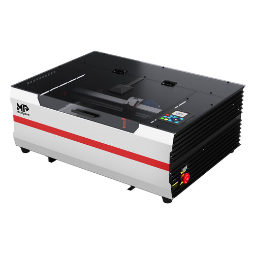
Monport 40W Lightburn-ready (12" X 8") CO2 Laser Engraver & Cutter

Why Use a Desktop CO2 Laser for Topographic Models?
A desktop CO2 laser offers unmatched precision, allowing you to cut and engrave terrain layers that reflect real-world elevation changes. This is especially valuable in physical geography where accurate representation of features like mountains, valleys, and slopes is essential.
Key Advantages:
-
Compact and easy to use
-
Works with a variety of materials
-
Delivers high engraving accuracy (up to 0.01 inch)
-
Fast operation speed (up to 13.8 ips / 350 mm/sec)
-
Compatible with Lightburn and Laser GRBL
These features make the Monport 40W desktop CO2 laser a practical tool for creating educational or presentation-ready terrain models.

Application Scenarios in Physical Geography
Using a desktop CO2 laser for geography projects is ideal for:
| Application | Benefit |
|---|---|
| Classroom Demonstrations | Visualizing landforms and elevation for students |
| Research Projects | Enhancing fieldwork data with physical models |
| Museum Displays | Building interactive educational exhibits |
| Urban or Environmental Design | Mapping flood zones or elevation for planning purposes |
| Student Presentations | Creating visual aids that boost clarity and engagement |
With the Monport 40W Laser Engraver, these scenarios become both practical and budget-friendly.
How to Create a Terrain Model Step-by-Step
To start creating topographic terrain models with a desktop laser cutter for physical geography, follow these steps:
-
Get Elevation Data
-
Use GIS software or platforms like USGS or OpenTopoMap.
-
Export data as contour lines or elevation layers.
-
-
Convert Data to Vector Format
-
Use software like QGIS or Adobe Illustrator to create SVG or DXF files.
-
-
Load into Lightburn
-
Import your vector file into Lightburn or Laser GRBL.
-
Set layer heights based on elevation.
-
-
Select Your Material
-
Use wood, acrylic, or layered cardboard for cutting.
-
Choose materials that are easy to stack and glue.
-
-
Cut and Assemble
-
Cut each elevation layer.
-
Assemble and glue layers in sequence to form the 3D terrain.
-
-
Finishing Touches
-
Add paint or texture to highlight elevation.
-
Mount the model on a board for stability.
-
This process makes creating topographic terrain models with a desktop laser cutter for physical geography accurate, efficient, and even fun.

Important Details to Consider
-
Workspace Size: The Monport offers an 8"x12" cutting area—ideal for most small-scale models.
-
Material Thickness: Best used with thin sheets (~1-3mm) to build elevation in layers.
-
Clamping Table: Secure your material for high precision.
-
Software Compatibility: Fully compatible with Lightburn for user-friendly design control.
-
Safety: Safety glasses are included to protect your eyes during laser operation.

Frequently Asked Questions
Q: Can beginners use the Monport 40W CO2 laser for geography models?
A: Absolutely! With simple setup, user-friendly software, and an intuitive interface, it’s great for hobbyists and educators alike.
Q: What materials work best for topographic models?
A: Plywood, MDF, acrylic, and cardboard are excellent for layering elevation maps.
Q: Is special software required?
A: The engraver works with Lightburn and Laser GRBL, which are widely used and easy to learn.

Key Takeaways
-
Creating topographic terrain models with a desktop laser cutter for physical geography is practical, engaging, and accurate.
-
The Monport 40W Lightburn-ready desktop CO2 laser is compact, precise, and fast.
-
Ideal for classrooms, museums, and environmental studies.
-
Easy-to-use software and safety features make it accessible for all levels.

Ready to Bring Terrain to Life?
If you're looking for a reliable tool to build precise terrain models and expand your creative or educational projects, the Monport 40W Lightburn-ready CO2 Laser Engraver is your best choice. With speed, accuracy, and versatility, this laser cutter will help you transform digital maps into tangible, layered models that impress and inform.